![]()
|
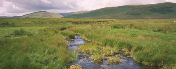
The present day property known as Crookedstane Rig once formed
part of a much larger holding that stretched for thousands of acres
on both sides of the present-day A74(M) road north of Beattock in
the Southern Uplands of Scotland. It was used for sheep farming.
When the original owner, a bachelor, discovered in the 1970's that
he was dying of an incurable disease, he began to sell off chunks
of his land, first to the Forestry Commission, then to myself and
another owner for private forestry, and lastly, the farmhouse itself
and its outbuildings and surrounding land to another family where
they raise llamas as well as sheep. I bought my share of Crookedstane Rig for forestry plantation without seeing it. I was desperate to invest in forestry a wonderful windfall which I had received on the 50th anniversary celebrations of my father's firm, and time was running out to qualify the investment for tax allowances. Little did I guess then (in 1983) what joy and interest the place was to bring me when, in 1994, with my husband's help after he retired, I built a little house at Crookedstane and we moved to live there. Luckily, I have kept diaries recording those early days and will post excerpts on the website. |
|